


Image source: Pixabay.com
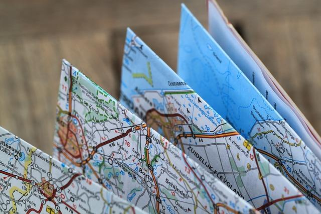
Many of us own at least three detailed maps at home: local, state and regional. Whether we keep them as travel references, or store them in survival kits as preps for a disaster, there’s no question that road maps are invaluable for land navigation.
We also often rely on GPS, yet in a long-term blackout, a grid-down scenario or very poor weather, it may not always work.
Paper maps and atlases, though, always will be reliable. Besides giving us a visual image of where we’re going, they are hard, tangible copies that we can actually hold with our hands and keep inside our pockets.
While road maps are indeed imperative, there are a few other maps worth obtaining. These are detailed references to not only paved roads but also to less-travelled, ignored and possibly unused passageways you can use if you want to avoid crowds and bypass checkpoints, and move in stealth. Many of these maps are available online, for free or at reasonable prices.
New Solar Oven Is So Fast It’s Been Dubbed ‘Mother Nature’s Microwave’
1. Topo map. Topographic maps show you the terrain of any given area. They have contour lines or squiggles that curve around hills and mountains, signifying their shape and elevation. Lines drawn closer together show steeper slopes, and those spaced far apart show gradual ones. Topo maps also identify key terrain features like peaks, valleys, ridges, cliffs, drainage areas like brooks and rivers, as well as sinkholes. You’ll find those details helpful in plotting your route when hiking, cycling or off-road driving. Most topo maps also show bodies of water, forest cover and major towns and settlements. The US Geological Survey has topo maps for free here. If you’d like specifications made according to specific scale, grid lines, shading and print size, MyTopo.com makes custom topographic maps using the military grid reference system.
Story continues below video
2. Google Earth map. Get a recent photo of your desired area from Google Earth, which shows satellite imagery of the terrain and its surroundings as they are, street-level, in 3D. Update every year and you’ll be able to see what changes have taken place over recent months. Perhaps a water source has dried up, a road has been closed off, or some new structures have sprung up.
Produce Boiling Hot Water, Anywhere, Anytime With Absolutely No Power Whatsoever…
Google Earth maps also show details you won’t be able to see on any other map, like trees, power plants, layout of buildings, a windmill, etc. If the file ends up too big for printing, download it to a USB, an then take it to a local print shop and have it printed on a pen plotter.
3. Wildlife management area map. There are highly detailed Forest Service and Bureau of Land Management maps that show campgrounds, hiking and off-road vehicle trails, lakes and streams, first-aid and supply stations, and even logging and fire routes. DeLorme and Thomas Guide publishers make excellent hybrid atlases with equally detailed info on trails, campsites, fishing spots and boat ramps.
4. County map. Some counties keep detailed maps of secondary roads, including back country gravel roads. These can come in handy if hurricanes or flooding hit a nearby city, necessitating evacuation. While freeways and major roads could be jammed with traffic, back roads will remain passable. County maps also will show railroad track routes, which can provide a safer, less conspicuous alternative if you find yourself having to go on foot. Check with your county assessor or county highway department. Keep an eye out, too, for old maps at libraries, yard sales and antique shops. These might show old roads that don’t exist anymore, or ghost towns and structures that have long been forgotten. Old abandoned buildings, though untended, might still be intact and be made livable during a worst-case scenario — at least temporarily.
A Few Tips
Laminate your maps. You could use Ziploc or map/chart bags to protect your maps from moisture, dirt and general wear-and-tear, but lamination would make them a lot more durable. Plus, it’ll allow you to mark your route and underscore landmarks with highlighters or dry-erase markers.
If you’re planning to bug out, do a recon. See if what you see on your map is actually what’s there when you get your boots on the ground. Plan your routes from your home and place of work to a pre-arranged meeting place with your family or group. Make sure each member has maps and knows how to use them.
Story continues below video
If you need help with map reading and compass use, get in touch with your local Boy Scout troop. They might allow you to sit in during orienteering sessions, and participate during field practice. Local search-and-rescue (SAR) teams might offer similar training, as might hunter safety courses.
Get a couple of the above maps. They could save your life.
What survival advice would you add about maps? Share your survival knowledge in the section below:
Learn How To ‘Live Off The Land’ With Just Your Gun. Read More Here.


